 Maps Maps
| TIF maps | List of Villages | House Lists | |
| Printable versions of the maps (download the TIF files from the TIF maps and print at 400 dpi) | List of villages on the Burgenland Bunch Map pages, including a complete multilingual index with ca. 2000 entries for 875 villages and links to Maps, Houselists, Photos, History, etc. | Pages with house numbers and the names of the "head of house" for every village in Burgenland. There is also a complete list of 12,800+ surnames (from 85,000+ families) | |
|
Neusiedl - Eisenstadt - Mattersburg - Oberpullendorf - Oberwart - Güssing - Jennersdorf |
|
east of Sopron - east of Güssing - south of Jennersdorf - Mosón Hansag area |
|
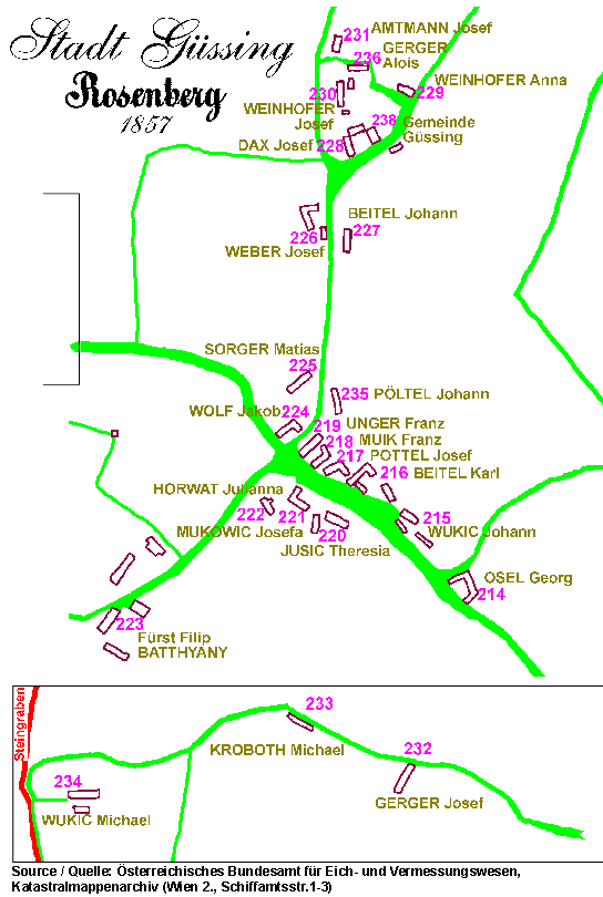
Villages: Rosenberg |
|
|
|
Here you can find maps of the Burgenland districts and the nearby neighbor
regions. |
||
| Eisenstadt map of district (overview 83 kB) larger map (127 kB) villagelist |
Neusiedl map of district (overview 107 kB) larger map (291 kB) villagelist |
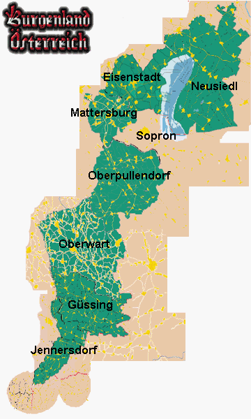 |
| Mattersburg map of district (overview 168 kB) larger map (239 kB) |
east of Sopron map of district (overview 168 kB) larger map (239 kB) |
|
| Oberpullendorf map of district (overview 279 kB) larger map (327 kB) |
Oberwart map of district (overview 491 kB) larger Map (536 kB) |
|
| Güssing map of district (overview 95 kB) larger map (160 kB) villagelist |
east of Güssing map of district (overview 175 kB) |
|
| Jennersdorf map of district (overview 130 kB) larger map (179 kB) |
south of Jennersdorf map of district (overview 163 kB) |
|
|
|
||
| Rosenberg | ||
| Rosenberg 1857 (20kB) (with houses and family names) | ||

by Klaus Gerger
April 13, 2017
Any comments or suggestions are welcome.
ALL RIGHTS RESERVED
PERMISSION TO COPY GRANTED, BUT PROVIDE CREDIT
Burgenland Bunch Logo by Michael Spahitz